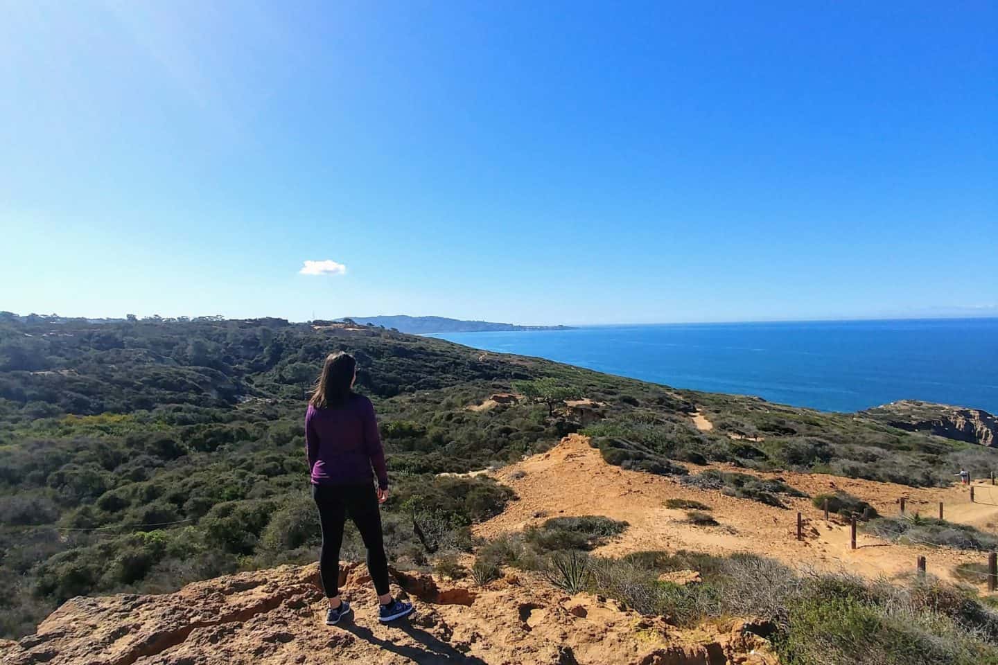
If you’re searching for one of Southern California’s most breathtaking coastal hikes, look no further than Torrey Pines State Natural Reserve in San Diego. Perched atop rugged sandstone cliffs overlooking the Pacific Ocean, this protected wilderness offers some of the most spectacular hiking trails in California — where desert landscapes meet the sea.
Named after the rare Torrey Pine tree (Pinus torreyana), which grows naturally in only two places on Earth — here and on Santa Rosa Island — this reserve is a sanctuary for native flora, migratory birds, and dramatic coastal views. Every twist of the trail reveals something new: windswept ridges, fragrant sage scrub, and sweeping vistas of endless blue ocean.
Torrey Pines hiking is an unforgettable experience for both beginners and seasoned hikers. Whether you’re exploring the short Guy Fleming Trail, tackling the cliffside Razor Point Trail, or descending the scenic Beach Trail to the shore, each route offers its own distinct charm. The reserve’s well-maintained trails, interpretive signs, and stunning natural scenery make it one of the top places for hiking in San Diego.
Whether you’re chasing a sunrise over sandstone bluffs or exploring the unique ecosystems that define this coastal sanctuary, Torrey Pines hikes offer something for everyone — from leisurely walks to cliffside adventures
In this guide, you’ll find everything you need to plan your perfect day at Torrey Pines — from detailed trail descriptions and history to insider tips, a suggested hiking itinerary, FAQs, and nearby attractions to make your visit truly memorable.

Disclaimer: This post may contain affiliate links. All this means is that we will make a small commission at absolutely no cost to you! This helps us be able to continue to run Diana’s Healthy Living and we thank you for your help!
History of Torrey Pines State Natural Reserve
Table of Contents
Indigenous Roots
Long before it became a protected state reserve, the area now known as Torrey Pines State Natural Reserve was home to the Kumeyaay people, who inhabited coastal San Diego for thousands of years. They relied on the region’s rich ecosystem — fishing in the lagoon, gathering coastal plants, and using the bluffs for shelter and navigation. Evidence of their presence, including shell middens and artifacts, has been found throughout the reserve and nearby coastal areas.
The Discovery of the Torrey Pine
In the early 1800s, botanists and explorers began cataloging California’s native species. Among them was the rare Torrey pine (Pinus torreyana), first described by Dr. Charles Christopher Parry and later named in honor of Dr. John Torrey, a prominent 19th-century American botanist.
This tree is now recognized as the rarest pine species in North America, found naturally only in two places:
- Torrey Pines State Natural Reserve in San Diego
- Santa Rosa Island, part of the Channel Islands off the California coast
The Torrey pine thrives in dry, coastal conditions and has adapted to the area’s harsh winds and sandy soil. Its twisted branches and thick needles help it conserve moisture and survive the ocean breeze — making it an iconic symbol of resilience in the Southern California landscape.
Conservation and Protection Efforts
By the early 1900s, development along the San Diego coast threatened this fragile ecosystem. Local conservationists, led by philanthropist Ellen Browning Scripps, took action. Scripps purchased and donated large sections of land to protect the rare trees and the surrounding landscape.
In 1899, the City of San Diego declared the site a public park to safeguard the pines. By 1959, it became part of the California State Park system, and in 1970, it was officially designated the Torrey Pines State Natural Reserve, highlighting its scientific, historical, and ecological importance.
Today, the reserve is co-managed by the Torrey Pines Conservancy and California State Parks, ensuring that its trails, wildlife, and forests are preserved through restoration and public education.

Cultural & Geological History of Torrey Pines
Beyond its rare trees and scenic beauty, Torrey Pines State Park tells a story that stretches back millions of years. The cliffs and canyons that make this area so stunning were shaped by powerful geological forces over time.
Ancient Ocean Origins
The golden sandstone bluffs that define Torrey Pines San Diego were formed from ancient marine sediments over 45 million years ago, during the Eocene epoch. As sea levels changed, waves and wind slowly eroded the coastal shelf, creating the dramatic cliffs you see today.
The visible sandstone layers — especially along the Razor Point and Broken Hill Trails — reveal a record of shifting climates and rising seas. Fossilized shells, ancient plant remains, and trace impressions can still be found embedded in the rock, offering clues to the area’s prehistoric marine life.
The Shaping of the Landscape
Over centuries, rainfall and coastal winds carved deep canyons and sculpted the sandstone into striking formations such as “The Badlands” and “The Cliffs of Razor Point.” These unique geological patterns are why Torrey Pines trails are so visually captivating and constantly changing.
Even today, the cliffs remain active — portions occasionally collapse or erode during heavy rain, reshaping the coastline. This ongoing natural process is a reminder that Torrey Pines is not just a scenic hiking area, but a living geological classroom.
Cultural Significance
In addition to its natural wonders, Torrey Pines holds cultural importance as one of San Diego’s earliest protected landscapes. The area inspired local artists, photographers, and writers in the early 1900s who captured its coastal beauty and advocated for preservation.
During World War II, the high bluffs near Torrey Pines were used by the U.S. military as observation points for coastal defense. After the war, much of the land was returned to conservation use, helping expand what we now know as the Torrey Pines State Natural Reserve.
Why Hike in Torrey Pines?
- Unique ecosystem & rare pine: The torrey pines here (Pinus torreyana) grow naturally only in this area and on one Channel Island, making Torrey Pines State Natural Reserve a botanical treasure.
- Coastal panoramas & wildlife: Many torrey pines hikes traverse cliff edges overlooking the Pacific, and during migration season you might spot whales.
- Trails for all levels: From easy loops to more strenuous treks, Torrey Pines trails range in length, scenery, and difficulty.

Fun Facts About Torrey Pines History & Geology
- The Torrey pine is sometimes called the “twisted pine” for its gnarled shape caused by strong ocean winds.
- The Torrey Pines Golf Course, located just north of the reserve, was once part of the same natural landscape before being developed.
- Cliff erosion at Torrey Pines happens at an average rate of 6 inches per year — meaning the park’s terrain is constantly evolving.
- Some sandstone formations within the reserve contain fossilized mollusks and marine organisms dating back millions of years.
- The Guy Fleming Trail was named after an early park naturalist who helped map and protect the reserve in the 1920s.
Essential Gear & Tips for Hiking Torrey Pines
Before you hit the Torrey Pines hiking trails, here’s what to bring:
- Be wary of snakes – rattlesnakes and other native snakes inhabit the reserve; keep children close, and don’t disturb wildlife.
- Water, sunscreen, hat & sunglasses – sun exposure is strong along cliffs.
- Good walking shoes – especially for steeper routes like Broken Hill or Beach Trail.
- Check tide tables – if planning to walk beach-access segments, especially for Torrey Pines beach hike portions.
- Stay on marked trails – off-route walking can damage fragile habitats and risk cliff collapse.
Torrey Pines Hiking Visitor Info & Hiking Tips
Best Time to Visit Torrey Pines
- Morning (8–10 AM): Cooler, less crowded.
- Evening (Golden Hour): Best light for photos.
- Avoid midday in summer — there’s little shade.
What to Bring
- Water & sunscreen
- Hat & sunglasses
- Comfortable shoes with grip
- Light snack
- Tide chart (if hiking the Beach Trail)
Rules to Remember
- No food, pets, or smoking in the reserve.
- Stay on marked trails — cliff edges are unstable.
- No drones or amplified music.
- Pack out everything you bring in.
Getting to Torrey Pines State Natural Reserve
Where It’s Located
Torrey Pines State Natural Reserve sits along the stunning San Diego coastline between La Jolla and Del Mar, just off Interstate 5 (I-5). The main entrance is located at:
12600 N. Torrey Pines Road, La Jolla, CA 92037
This beautiful stretch of protected land is easy to reach whether you’re driving from downtown San Diego or exploring the coast from the north.
Driving Directions
If you’re coming from Downtown San Diego, head north on I-5 and take the Carmel Valley Road exit. Drive west for about 1.5 miles until you reach Camino Del Mar / North Torrey Pines Road, then turn left (south). The entrance to the reserve is about one mile ahead on your right, at the base of the hill leading into the park.
You’ll see clear signs for both Torrey Pines State Beach and Torrey Pines State Natural Reserve — they share the same access road.
Drive Times & Best Arrival Tips
- From Downtown San Diego: about 20–30 minutes (roughly 18 miles)
- From La Jolla Village: around 10–15 minutes
- From Del Mar: just 5–10 minutes
Pro tip: Plan to arrive early — ideally before 8 AM — especially on weekends or holidays. Parking fills quickly, and the early morning light is perfect for photos.
Parking at Torrey Pines
There are two main parking areas:
- Lower Lots – Located near the beach and entrance station (South and North Beach lots). Great if you plan to start with the Beach Trail or explore the sand after your hike.
- Upper Lot – Located near the Visitor Center at the top of the hill. Perfect for starting the Guy Fleming, Razor Point, or Parry Grove trails.
A day-use fee applies (cash or card accepted). The lower lots often fill by mid-morning, so arriving early is highly recommended.
Getting to Torrey Pines Without a Car
You can still visit Torrey Pines San Diego if you don’t have a car, though it takes a bit more planning.
- From Downtown San Diego, take the Blue Line Trolley to UTC Transit Center, then hop on Bus 101 toward Oceanside.
- Get off near North Torrey Pines Road, just a short walk from the reserve entrance.
- Another option is taking the Coaster train to Solana Beach Station, then catching a rideshare or local bus to the park.
Expect the total trip to take about 1.5 to 2 hours, depending on transfers. Schedules can vary, so check the latest times before heading out.
Walking or Biking to the Reserve
If you’re staying nearby in Del Mar or La Jolla, you can easily bike or walk along the coastal route. Cyclists can ride up to the reserve gate but should note that bikes are not permitted on the hiking trails themselves. There are racks available near the entrance.
Local Tips for a Smooth Visit
- Enter the exact address above in your GPS — not “Torrey Pines Golf Course,” which can misdirect you.
- Bring sun protection, water, and your camera — this coastal route offers incredible views before you even start hiking.
- Arrive early for cooler temperatures, fewer crowds, and available parking.
- If taking transit, confirm your return route times since service can be limited later in the evening.

Best Time to Visit Torrey Pines State Natural Reserve
Torrey Pines State Natural Reserve is a year-round hiking destination, thanks to San Diego’s famously mild climate. But depending on what you want to experience — wildflowers, whale watching, or peaceful trails — some seasons are better than others.
Spring (March–May): Ideal for Wildflowers and Comfortable Weather
Spring is one of the best times to go hiking at Torrey Pines. The coastal hillsides bloom with wildflowers, the weather is mild (around 65–70°F / 18–21°C), and the skies are clear. You’ll see colorful coastal sagebrush, lupines, and sand verbenas lining the trails.
Why go:
- Comfortable temperatures for longer hikes
- Wildflowers and greenery after winter rains
- Great light for photography
Summer (June–August): Warm, Bright, and Busy
Summer brings sunshine and crowds. Expect warmer temperatures (mid-70s°F / 24°C), perfect for combining your Torrey Pines hike with a San Diego beach day. Mornings can start with the local “marine layer” — a light coastal fog — which usually burns off by late morning.
Tips for summer hiking:
- Arrive early (before 8 AM) to secure parking and avoid heat
- Bring plenty of water — shade is limited
- Ideal for Beach Trail and Guy Fleming Trail if you want shorter scenic routes
Fall (September–November): Fewer Crowds, Stunning Views
Fall is arguably the best overall season for hiking at Torrey Pines State Park. The weather is warm but not hot, crowds taper off after summer, and the ocean views are crystal clear. Sunsets this time of year are particularly breathtaking from Razor Point or Broken Hill Trail.
Why go:
- Great balance of weather and solitude
- Perfect for photographers
- Best time for late-day hikes and sunset views
Winter (December–February): Peaceful and Perfect for Whale Watching
Winter is quiet and cool at Torrey Pines San Diego — usually between 60–65°F (16–18°C). After light rain, the cliffs take on a richer hue, and the skies turn vivid blue. This is also gray whale migration season, so bring binoculars!
Why go:
- Clear coastal views
- Excellent for wildlife watchers
- Less crowded trails
Best Times of Day to Hike
- Early morning: Cooler temps, soft golden light, fewer people
- Late afternoon: Dramatic shadows on the cliffs, beautiful ocean sunsets
- Midday: Great for beach walks, but bring sun protection — it can get hot
Local Tip
The reserve opens around 7:15 AM and closes at sunset. Always check posted times at the entrance — they change slightly with the seasons. If you plan to hike the Beach Trail, aim to start early to enjoy low tide and easier access to the beach.
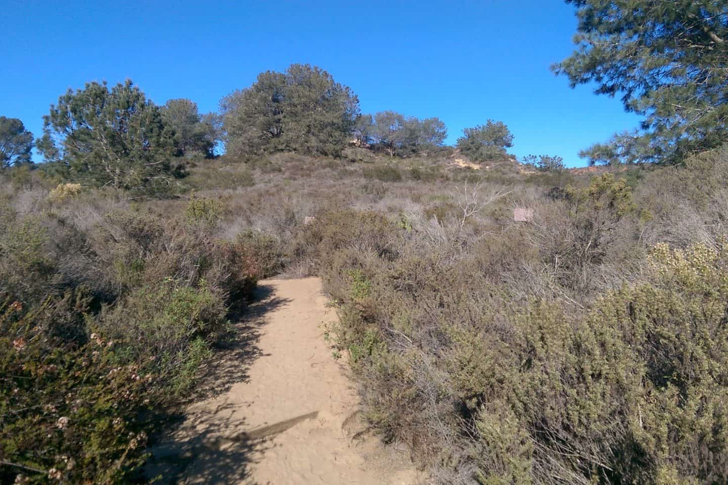
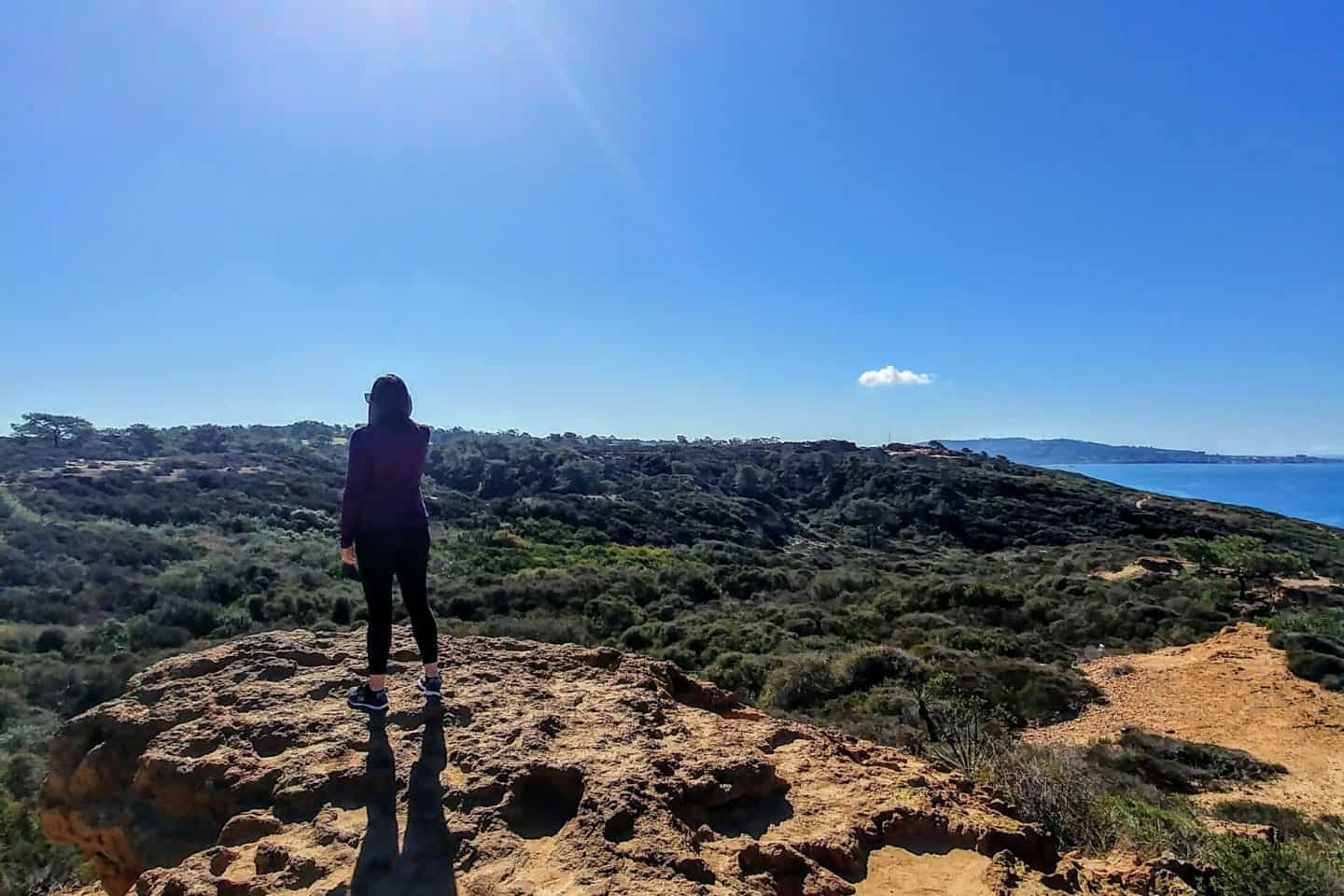
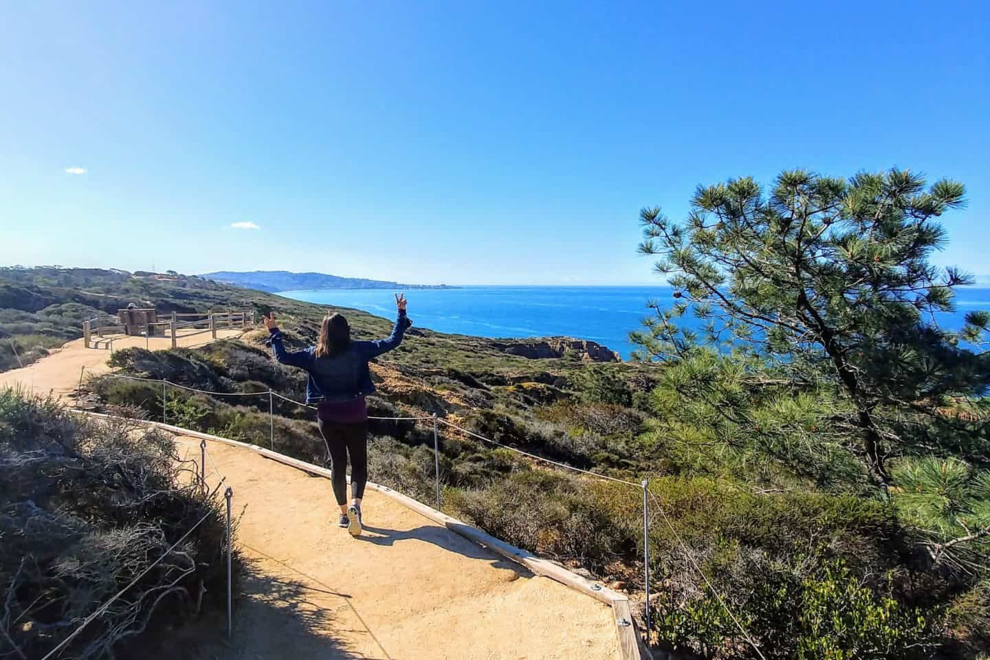
10 Hiking Trails in Torrey Pines State Natural Reserve
Torrey Pines State Natural Reserve has eight hiking trails of different lengths, which range in difficulty and scenery (although some sites list only six – minus the Yucca Point and Discovery Trails). The three most popular are Beach Trail, Razor Point Trail and the Guy Fleming Trail.
Many of these hiking trails connect together, so you may wish to combine sections to create a longer, more scenic hike that takes in the best scenery that a Torrey Pine hike has to offer.
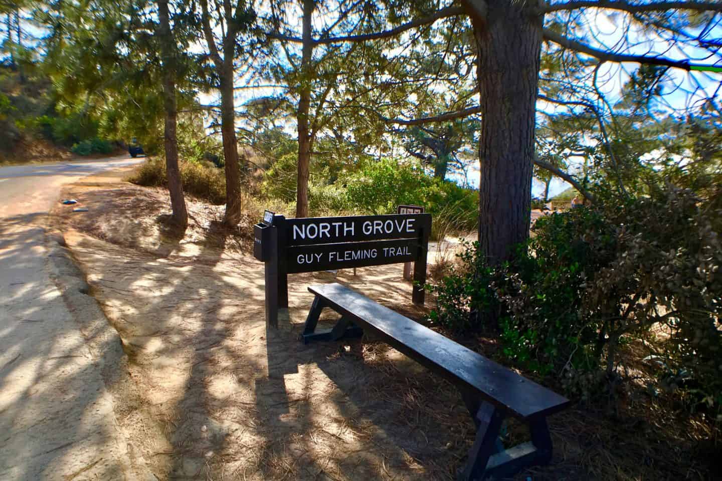
1. Guy Fleming Trail
Difficulty: Easy
Distance: 0.7 miles (loop) | Difficulty: Easy | Elevation Gain: ~100 ft
Named for Guy L. Fleming, one of California’s first park naturalists, this short and scenic loop perfectly captures the essence of Torrey Pines hiking.
The trail begins just north of the Visitor Center and winds gently through groves of twisted Torrey pines — their gnarled branches reaching toward the sea. As you follow the well-marked sandy path, the sound of waves drifts up from below, mingling with the scent of salt and pine resin.
Two overlooks punctuate the loop:
- North Overlook offers sweeping views of the Del Mar coastline, where you can often spot gliders soaring above the cliffs.
- South Overlook gazes toward La Jolla, with dramatic views of the sandstone formations sculpted by centuries of erosion.
Insider Tip: Visit in March or April when the trail bursts with wildflowers — especially California poppies, yucca blossoms, and bright monkeyflowers.
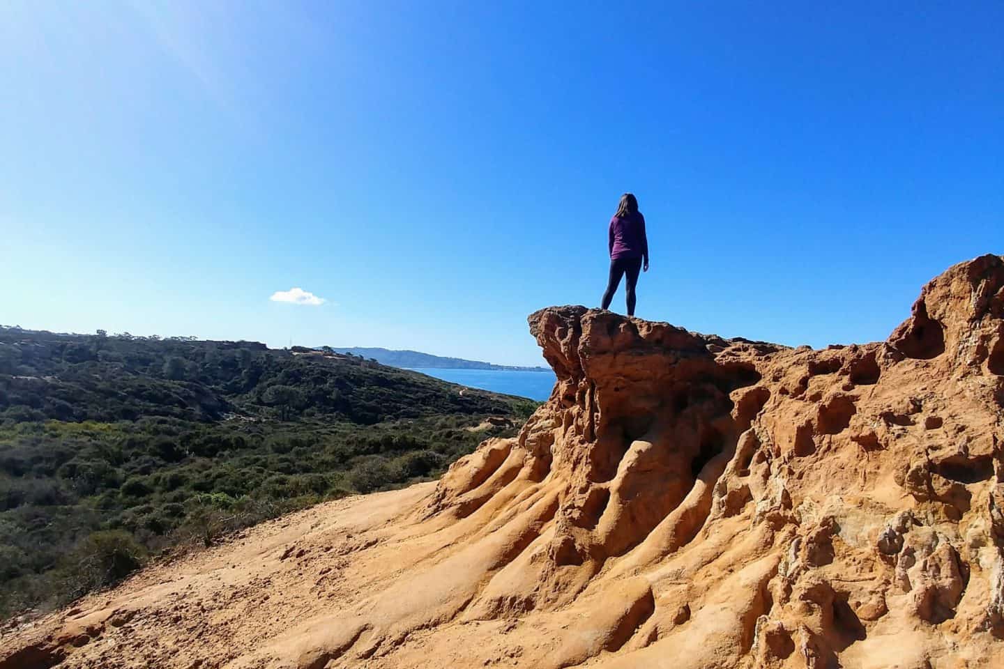
2. Razor Point Trail
Distance: 1.4 miles (loop) |
Difficulty: Easy–Moderate | Elevation Gain: ~200 ft
The Razor Point Trail is the park’s geological masterpiece — a living sculpture garden of wind-carved sandstone. The name “Razor Point” comes from the knife-like ridges that slice through the cliffs, formed by millions of years of erosion.
The path begins along a coastal bluff, meandering through low chaparral and coastal sage scrub, filled with aromatic plants like sagebrush, buckwheat, and chamise. As you approach the overlook, the earth seems to crumble into the sea, revealing dramatic, layered canyons in hues of gold and amber.
Highlights:
- The Razor Point Overlook offers one of the best vantage points in Torrey Pines State Park, with views of the Pacific stretching endlessly south.
- On clear days, you can spot La Jolla Cove and even the distant outline of Mexico’s Coronado Islands.
- Ideal for photographers — especially at sunset when the cliffs glow in soft orange tones.
Fun Fact: Early naturalists nicknamed this area “The Badlands” for its sharp ridges and erosion patterns that resemble miniature desert formations.
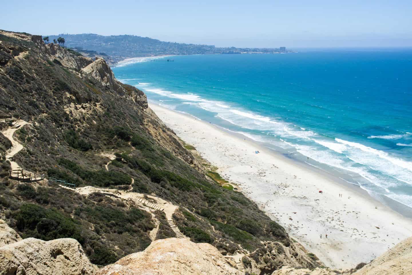
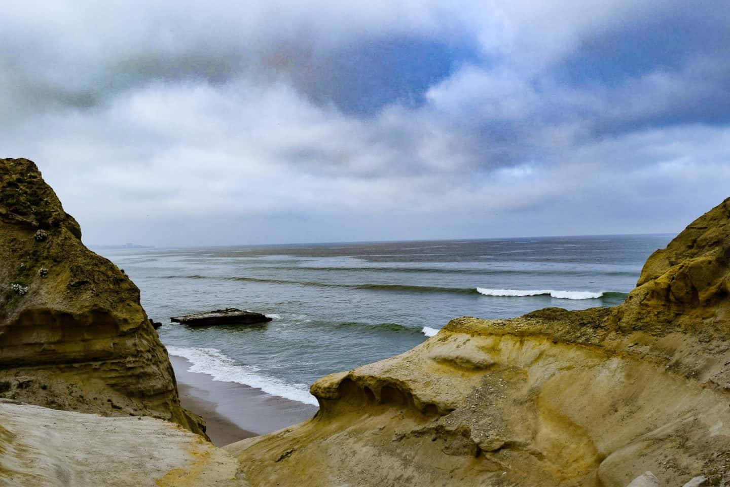
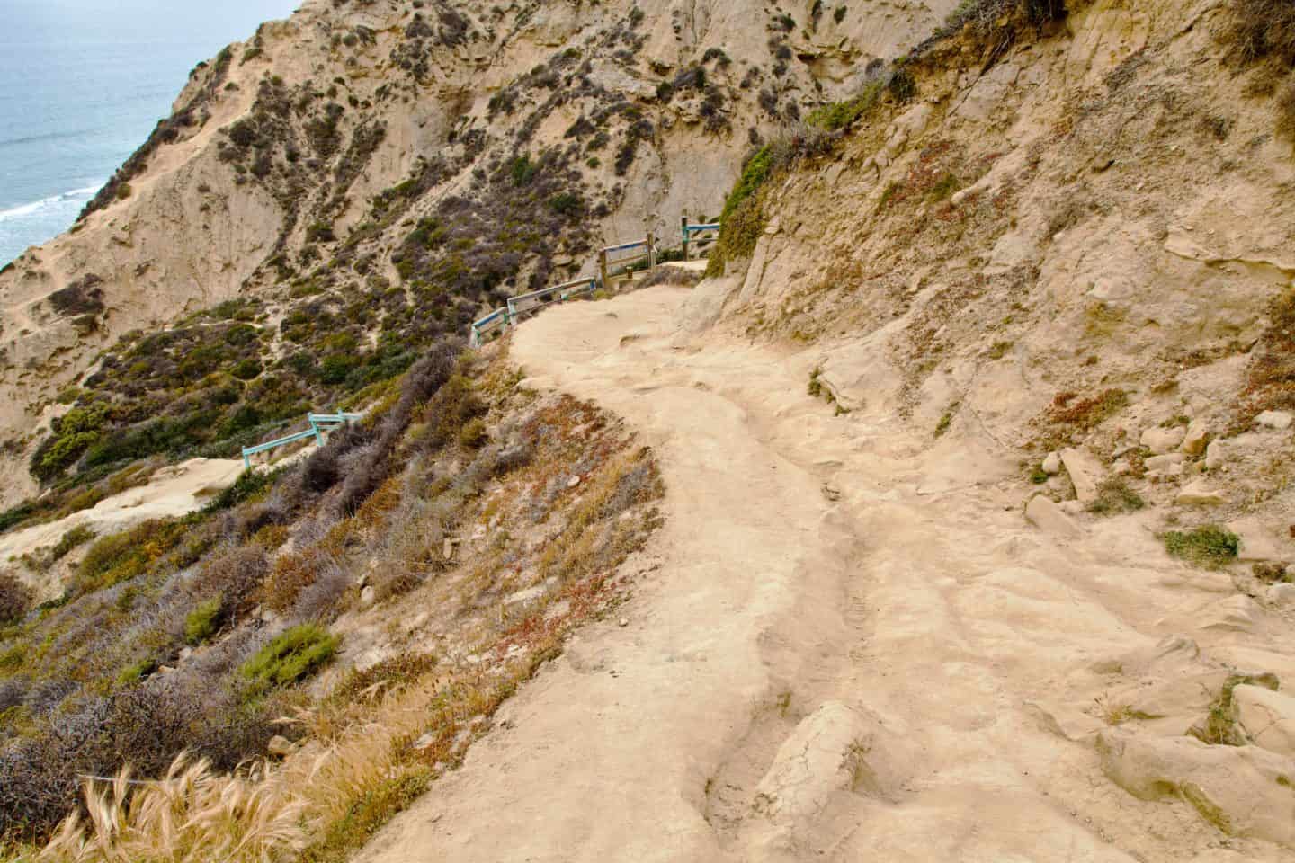
3. Beach Trail
Distance: 0.75 miles one way
Difficulty: Moderate–Steep | Elevation Gain: 300 ft
If you want a trail that leads straight to the ocean, the Beach Trail is your adventure. Starting near the upper mesa, it zigzags down the sandstone cliffs, passing through canyons and over wooden steps until it reaches the Torrey Pines State Beach below.
What You’ll Experience:
As you descend, the ocean breeze grows stronger, the scent of sea salt mixes with sage, and the waves become louder. The descent is exhilarating, but the real challenge is the climb back up — steep, sunny, and calf-burning.
At the Bottom:
You’ll arrive at Flat Rock, a massive sea stack that was once an isolated formation before the cliffs eroded behind it. It’s a favorite photography spot and the perfect place to rest, dip your toes in the surf, and admire the cliffs from below.
Caution: Always check the tide schedule — high tide can cut off access to the return route, and cliff falls are possible during wet weather.
4. Parry Grove Trail
Distance: 0.5 miles (loop)
Difficulty: Moderate | Elevation Gain: ~100 ft
A serene trail dedicated to Dr. Charles Christopher Parry, the botanist who first identified the Torrey pine, this loop feels like a peaceful retreat within the reserve.
The descent begins down a series of stone steps, leading to a shaded grove — a rare feature in an otherwise sun-drenched park. The trail circles through coastal scrub and native flora, eventually climbing back toward the main road.
Highlights:
- The Whitaker Garden, near the trailhead, showcases native California plants.
- Quiet seating areas make it perfect for meditation or journaling.
- Best in late winter and spring when blooms transform the grove into a tapestry of color.
Fun Fact: Parry’s fieldwork in the 1850s directly led to the naming of Pinus torreyana — the rarest pine species in North America.
5. Yucca Point Trail
Distance: 1.2 miles
Difficulty: Easy–Moderate | Elevation Gain: ~150 ft
Named for the resilient yucca plant, which thrives along its sunbaked slopes, this short connector trail is a hidden gem. It links the Razor Point and Beach Trails, offering a unique blend of geology and ocean scenery.
What You’ll See:
- Sculpted sandstone ridges glowing gold under the sun.
- Distant surfers carving waves below.
- Whale spouts offshore during migration months (December–March).
Atmosphere:
Less crowded than the main loops, Yucca Point feels wild and untamed. The wind whistles through the cliffs, and the salty air carries the rhythmic crash of the Pacific.
Tip: Visit during golden hour — the sunlight catches the cliffs, and the yucca blossoms illuminate against the deep blue sea.
6. High Point Trail
Distance: 0.1 miles
Difficulty: Short but Steep | Elevation Gain: ~100 ft
The High Point Trail may be short, but it offers the best panoramic view in all of Torrey Pines State Park. A quick, steep climb leads you to a 360° overlook with vistas of the lagoon, Del Mar coastline, and the rolling hills inland.
Why It’s Special:
During World War II, this high ridge was used as a lookout point for coastal observation. Today, it remains a favorite photography spot for sunrise and sunset shots.
Perfect For:
Visitors who want an incredible view with minimal hiking — great for first-time park goers or those short on time.
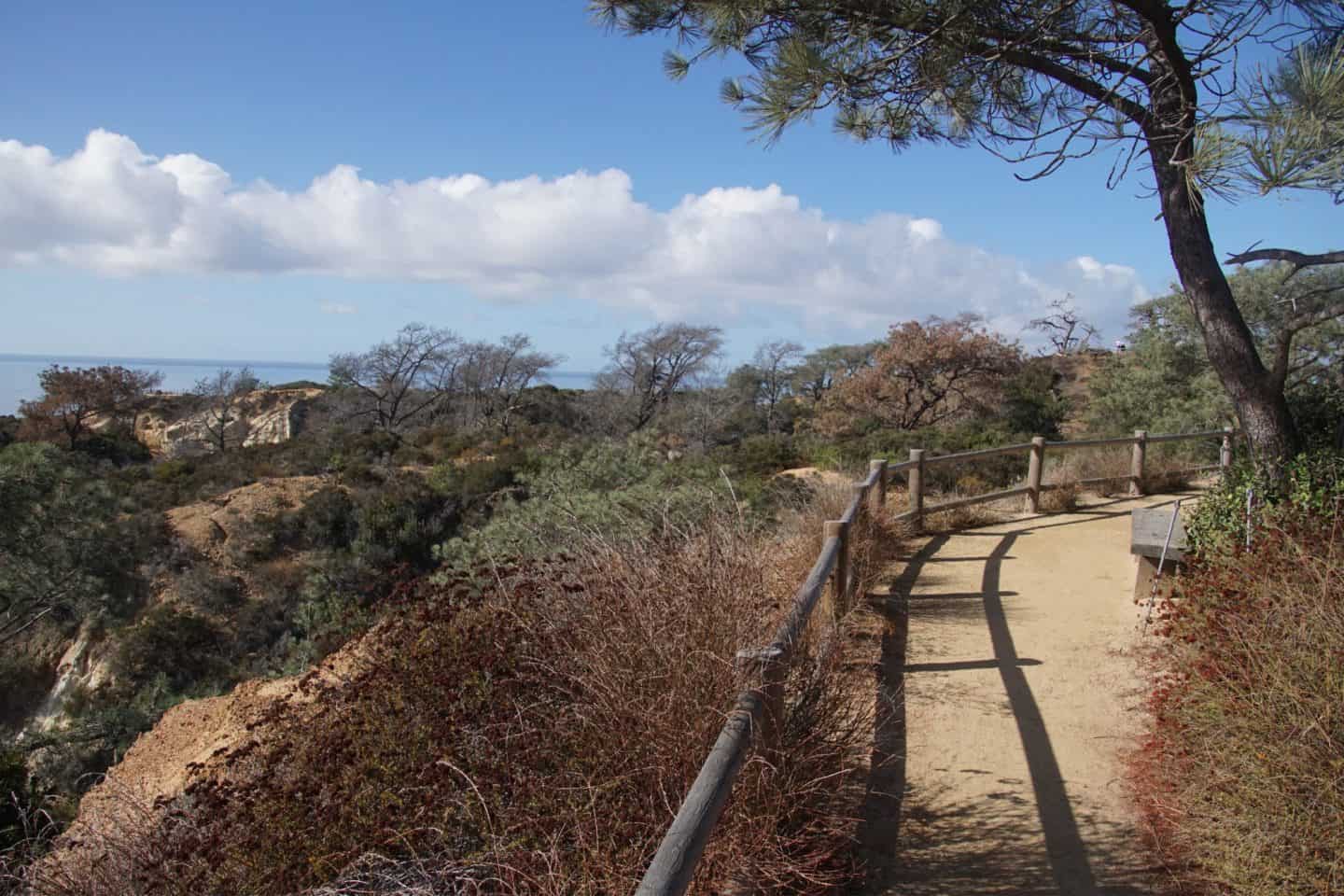
7. Broken Hill Trail
Distance: 2.5 miles round trip
Difficulty: Moderate | Elevation Gain: ~350 ft
The Broken Hill Trail is the longest and most rewarding hike in Torrey Pines State Natural Reserve — a sweeping loop that showcases the park’s rugged cliffs, ocean vistas, and tranquil pine groves.
The trail is divided into two branches:
- Broken Hill South Trail: A gentler path with wide-open ocean views.
- Broken Hill North Trail: Narrower and slightly steeper, weaving through dense chaparral.
Both routes converge at Broken Hill Overlook, a massive eroded bluff where a chunk of sandstone split away from the ridge long ago — creating a dramatic centerpiece that defines the reserve’s landscape.
Expect:
- Quiet solitude, away from the busier loops.
- Birds of prey (like red-tailed hawks) gliding over the cliffs.
- Occasional wild rabbits and lizards sunning along the path.
Photographer’s Tip: Arrive for sunrise or sunset — the golden light paints the cliffs in deep oranges and pinks.
8. Discovery Trail
Distance: 0.13 miles
Difficulty: Easy & Accessible
This short, paved loop near the Visitor Center is designed for education and accessibility. It’s lined with interpretive signs about the area’s flora, fauna, and history — making it a perfect introduction to hiking Torrey Pines.
Highlights:
- Ideal for families, seniors, or those with limited mobility.
- Views of the cliffs, ocean, and pines.
- Located next to the historic 1920s Lodge (the park’s Visitor Center).
Insider Note:
It’s one of the few places where you can touch and smell the Torrey pine needles up close — their long, five-needle clusters are unlike any other pine in California.
9. Torrey Pines Extension Trails (Bonus)
Distance: Varies (0.5–2 miles)
Difficulty: Easy–Moderate
North of the main reserve, the Torrey Pines Extension Trails offer a quieter, dog-friendly alternative. These paths meander through protected mesas overlooking Del Mar, surrounded by native chaparral and smaller groves of Torrey pines.
Popular Routes:
- Mar Scenic Trail – gentle, with views of Los Peñasquitos Lagoon.
- DAR Trail (Daughters of the American Revolution) – named after the local women’s group that helped preserve the land.
- Red Ridge Loop – a bit hillier, with golden light at sunset.
Why Visit:
Ideal for solitude, birdwatching, and off-the-beaten-path hiking. You’ll often have the trail to yourself — a rare luxury in San Diego.
10. Los Peñasquitos Lagoon Trail (Bonus)
Distance: ~1.5 miles
Difficulty: Easy | Elevation Gain: Minimal
Stretching between the cliffs and the wetlands, this trail showcases one of the few remaining coastal lagoons in Southern California. The Los Peñasquitos Lagoon Trail winds through tidal estuaries, salt marshes, and patches of dune vegetation.
What You’ll Experience:
- Herons, egrets, and ospreys hunting in the shallows.
- Boardwalks and sandy paths skirting the lagoon.
- Gentle ocean breezes and peaceful bird calls.
Why It Matters:
The lagoon acts as a natural filtration system and wildlife refuge. It’s a critical part of the ecosystem that supports both Torrey Pines State Beach and the reserve’s biodiversity.

Torrey Pines Hiking Tips and Trail Etiquette
Hiking at Torrey Pines State Natural Reserve isn’t just about the views — it’s about enjoying a truly special environment that’s been carefully protected for decades. These hiking tips and trail etiquette reminders will help you make the most of your visit while preserving the beauty of this rare coastal ecosystem.
1. Start Early for the Best Experience
Early mornings are magical at Torrey Pines. You’ll find cooler temperatures, soft golden light, and fewer crowds on the trails. Starting before 8 AM also gives you a better chance at parking and allows you to enjoy the peaceful sounds of the ocean before the day gets busy.
If you’re planning to do multiple Torrey Pines hikes — such as Guy Fleming Trail, Razor Point, or Broken Hill Trail — arriving early lets you explore at a relaxed pace.
2. Check the Tide Before Hiking the Beach Trail
If you plan to take the Beach Trail, always check the tide schedule first. At high tide, parts of the beach can become inaccessible or unsafe to pass. Low tide is the ideal time for exploring Flat Rock and the coastline below the cliffs.
You can find daily tide charts on local San Diego weather or surf websites.
3. Combine Trails for a Scenic Loop
If you want a longer, more varied hike, combine a few trails for a full Torrey Pines loop experience:
- Start at the Visitor Center (upper lot)
- Take the Razor Point Trail for panoramic views
- Connect to the Beach Trail to descend to the shoreline
- Walk north along the sand and exit via the lower parking lot or stairs
This route gives you cliffs, canyons, and ocean all in one — the best of Torrey Pines hiking in a single trip.
4. Stay on Marked Trails
Torrey Pines is a fragile environment where erosion happens easily. Always stay on the designated paths to protect the native plants and preserve the sandstone formations. Shortcuts and off-trail walking may seem minor but can cause long-term damage to the ecosystem.
5. Respect the Wildlife
You’ll likely spot lizards, rabbits, hawks, and even migrating whales in the distance. Keep your distance and observe quietly — feeding or approaching wildlife is prohibited. Bring binoculars if you want a closer look at birds or marine life.
6. Hike Smart and Light
Bring only what you need, and always carry out what you bring in. There are no trash cans along the trails, so be prepared to pack out any waste.
If you’re visiting in summer, plan shorter routes or take breaks in shaded areas near the Guy Fleming Trail or Parry Grove Trail.
7. Safety and Comfort Tips
- There’s no drinking water on the trails — fill up before you start.
- Cell service can be spotty, so download the Torrey Pines trail map ahead of time.
- Wear sunscreen even on cloudy days — the coastal sun can be deceiving.
- Hiking poles can help with sandy or uneven terrain on the Broken Hill and Beach Trails.
8. Leave No Trace
Follow the classic Leave No Trace principles — stay on trails, pack out your trash, and respect other visitors. Everyone comes to Torrey Pines State Park to enjoy nature’s calm; keep noise levels low and take only photos and memories.
Make sure to check the park website for updates on closed trails.

Suggested Torrey Pines Hiking Itinerary
Here’s a sample half-day itinerary that lets you experience the best of Torrey Pines San Diego:
8:00 AM – Arrive Early
Park in the lower lot or walk in to avoid parking fees. Begin your ascent via the Beach Trail Access Road to the upper plateau.
8:30 AM – Explore the Guy Fleming Trail
Start with the Guy Fleming Trail, a scenic 0.7-mile loop offering sweeping ocean views and interpretive signs about native flora.
9:15 AM – Continue on the Razor Point Trail
From the upper area, take the Razor Point Trail (1.3 miles roundtrip) for stunning cliffside overlooks and desert-meets-ocean scenery.
10:00 AM – Descend the Beach Trail
Follow the Beach Trail (0.75 miles each way) down to the sandy shore. Stop to enjoy the views from the lookout points before reaching the beach.
11:00 AM – Relax at Torrey Pines State Beach
Take a break, have a snack, or dip your toes in the Pacific Ocean. If the tide is low, walk north along the beach to Flat Rock for unique geological formations.
12:00 PM – Return and Explore the Visitor Center
Hike back up or exit through the lower lot. Visit the Visitor Center (the historic Lodge) to learn more about the Torrey Pine tree’s history and conservation efforts.
Optional Add-Ons
- Spend the afternoon at La Jolla Cove to see sea lions and enjoy the vibrant coastal energy.e.
- Stop by Del Mar Village for lunch by the sea.
- Visit the Torrey Pines Gliderport for panoramic views or paragliding.

Torrey Pines Hike Map
Before heading out on a Torrey Pines Hike, check the Reserve’s online map of Torrey Pines for restroom information as well as water stations and parking.

Things to Do Near Torrey Pines
After you’ve finished your Torrey Pines hike, take some time to explore the surrounding San Diego coastline. From breathtaking beaches to scenic viewpoints and delicious local dining, this area is full of experiences worth adding to your itinerary.
Torrey Pines Gliderport
Just a short drive south of the reserve, the Torrey Pines Gliderport offers one of the most stunning coastal views in California. Watch paragliders launch off the cliffs or even book a tandem flight to soar above the Pacific Ocean.
📍 Location: 2800 Torrey Pines Scenic Drive, La Jolla
💡 Tip: Sunset flights are spectacular, especially on clear evenings.
Del Mar Beach
Located just north of the reserve, Del Mar Beach is perfect for a post-hike swim or relaxing on the sand. The nearby Del Mar Village has charming shops, ocean-view restaurants, and a laid-back coastal vibe.
🍴 Where to eat: Try Jake’s Del Mar or Poseidon for beachside dining.
La Jolla Cove
A 15-minute drive south brings you to La Jolla Cove, a favorite for snorkeling, kayaking, and spotting sea lions basking on the rocks. It’s one of San Diego’s most photographed spots and a great place to unwind after hiking Torrey Pines trails.
💡 Don’t miss: The sea caves along the La Jolla coast — kayak tours are available year-round.
Black’s Beach
For a more secluded coastal walk, head down to Black’s Beach, located below the Gliderport. Known for its dramatic cliffs and wide sandy shoreline, it’s a popular surf spot and one of the most scenic beaches in the region.
⚠️ Note: The path down is steep and not recommended after rainfall.
Del Mar Village
Wander through Del Mar Village to explore boutique shops, wine bars, and coastal restaurants. The area is especially lovely in the evening when ocean breezes and twinkling lights create a romantic ambiance.
Birch Aquarium at Scripps
Perfect for families or anyone curious about marine life, the Birch Aquarium in La Jolla offers interactive exhibits on ocean science and conservation. It’s just a short drive from Torrey Pines State Natural Reserve and a great educational stop.
Where to Stay Near Torrey Pines
If you want to extend your visit, consider staying nearby:
- Les Artistes Inn, Del Mar – A charming boutique hotel ideal for couples.
- The Lodge at Torrey Pines – A luxurious craftsman-style resort overlooking the golf course, just steps from the reserve.
- Hilton La Jolla Torrey Pines – Comfortable and convenient with ocean views.

Frequently Asked Questions About Torrey Pines Hiking
How long are the hikes at Torrey Pines?
The Torrey Pines hiking trails range from easy 0.7-mile loops like the Guy Fleming Trail to longer 2.5-mile routes such as the Broken Hill Trail. You can combine several trails to create a moderate 3–5-mile loop that showcases the best ocean and cliff views.
Do you have to pay to hike at Torrey Pines?
Yes, there’s a parking fee to enter Torrey Pines State Natural Reserve. The cost is typically $10–$25 per vehicle, depending on the lot and day of the week. Entry for hikers and cyclists is free if you park outside the reserve and walk in.
What is the best time to hike Torrey Pines?
The best time for hiking at Torrey Pines is early morning or late afternoon when temperatures are cooler and lighting is ideal for photography. Spring and fall offer comfortable weather and fewer crowds.
How difficult are the Torrey Pines hikes?
Most trails are rated easy to moderate. The elevation gain is minimal, and paths are well-marked. The Beach Trail includes a steep descent to the shoreline, which can feel more challenging on the return climb.
Are dogs allowed at Torrey Pines?
No, dogs are not permitted anywhere in Torrey Pines State Natural Reserve, including on the trails and beach areas. This policy protects native wildlife and vegetation.
Can you swim or relax on the beach after hiking?
Yes! After completing your Torrey Pines hike, you can access Torrey Pines State Beach via the Beach Trail or the lower parking lot. It’s a beautiful spot for a refreshing dip or a post-hike picnic.
Is Torrey Pines family-friendly?
Absolutely. The Guy Fleming Trail and Discovery Trail are short, safe, and scenic, making them perfect for families with children or beginner hikers.
Are there restrooms or water fountains on the trails?
Restrooms are available at the upper and lower parking lots, but there are no facilities or water fountains along the hiking trails. Be sure to bring plenty of water, sunscreen, and a hat.

More Hiking Trails in the Torrey Pines Natural Reserve Extension
For even more hiking options, consider the Mar Scenic Trail (0.5 miles), Daughters of the American Revolution Trail (0.5 miles), the Margaret Fleming Nature Trail (0.75 miles), or the Red Ride Loop Trail (0.33 miles), which can be found in the reserve extension.
Closing: Why Torrey Pines Belongs on Every Hiker’s Bucket List
A day spent at Torrey Pines State Park is a reminder of how powerful and peaceful nature can be. As you hike along the sandstone cliffs, surrounded by the scent of coastal sage and the sound of waves below, it’s easy to see why this reserve is considered one of San Diego’s natural treasures.
Whether you came for a quick coastal stroll or a half-day hiking adventure, the beauty of Torrey Pines hikes lies in their simplicity — no crowds, no noise, just the rhythm of your footsteps and the vastness of the Pacific. Each trail tells a story, shaped by wind, sea, and time.
When you reach the end of your hike, take a moment to pause at one of the overlooks and breathe it all in — the glistening water, the warm breeze, the sense of calm. This is hiking at Torrey Pines at its finest: a rare combination of serenity and coastal grandeur that lingers long after you’ve left the trail.
So lace up your boots, pack your water bottle, and set out to explore one of California’s most scenic coastal parks. Torrey Pines State Natural Reserve isn’t just a place to hike — it’s a place to reconnect with nature, recharge your spirit, and experience the very best of the San Diego coastline.
If you are looking for some more California travel inspiration, check out:
Top Things to Do in California to Add to Your Bucket List
Top 10 Things to Do in San Diego
Best Places to Visit in California
Raya Ritz Carlton Laguna Niguel
Enjoyed reading Torrey Pines Hiking, PIN IT!